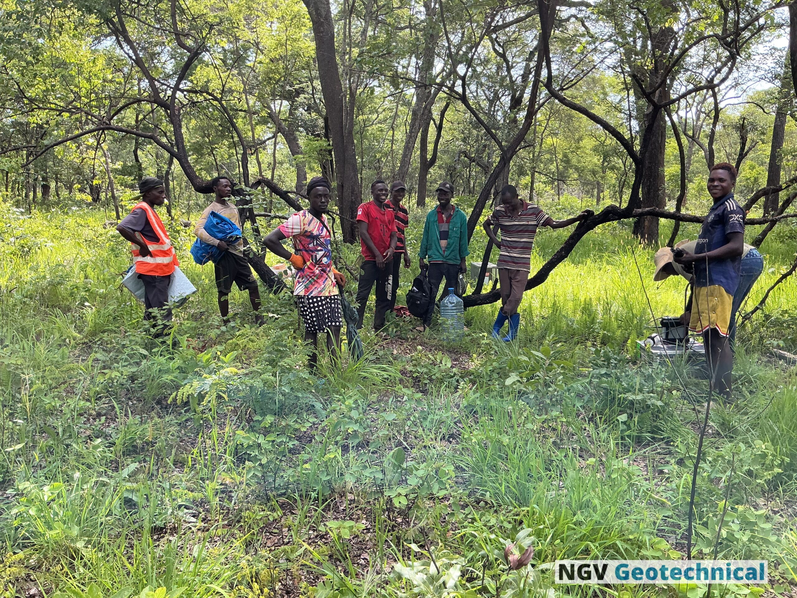
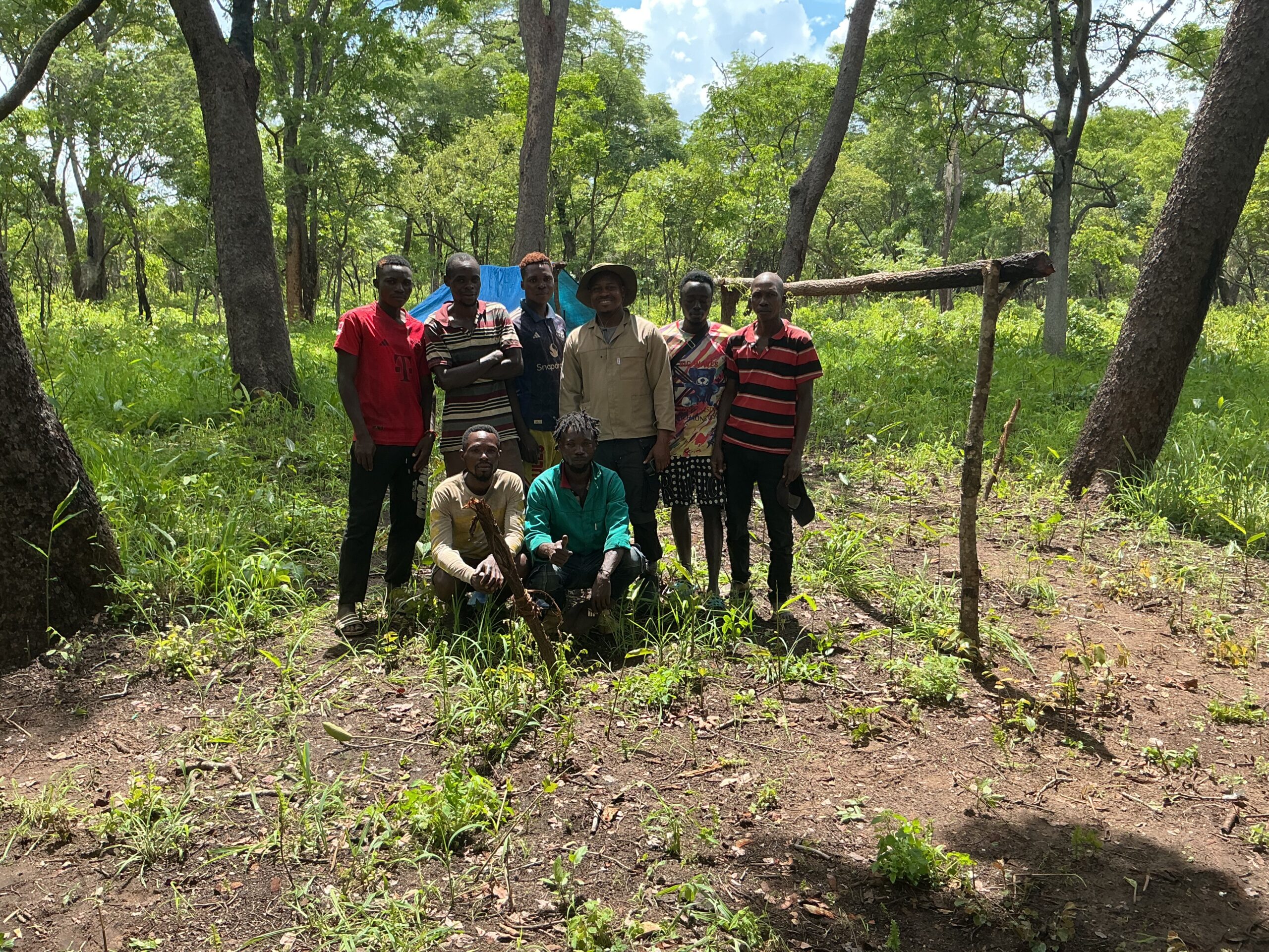
Geophysical Methods
NGV Geotechnical provides a range of geophysical survey methods to help clients understand subsurface conditions and identify potential resource targets.
Our services include techniques such as magnetic, gravity, electrical, and electromagnetic surveys to detect variations in the physical properties of the Earth.
By integrating advanced technology with expert data processing and interpretation, we deliver accurate and reliable geophysical insights that support mineral exploration, ground water, environmental studies, and infrastructure planning.
- Mining & Mineral Exploration
- Environmental & Groundwater Studies
- Civil Engineering & Construction
- Energy & Renewable Resources
- Oil & Gas Exploration
- Government Geological Surveys
- Oil & Gas (Hydrocarbon Exploration)
- Energy Transition & Renewable Projects
- Archaeology and heritage research
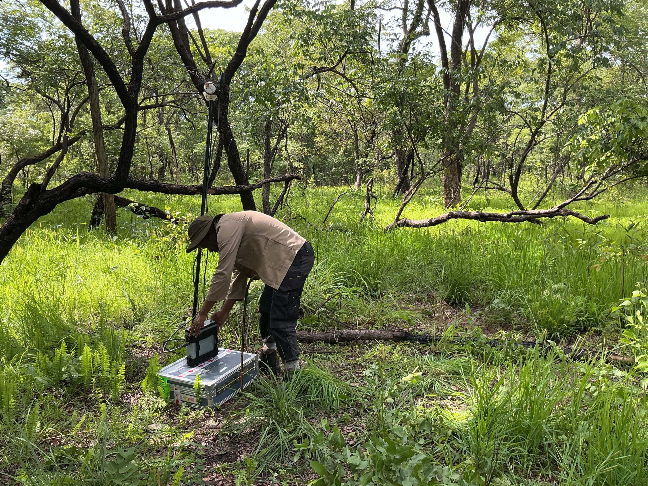
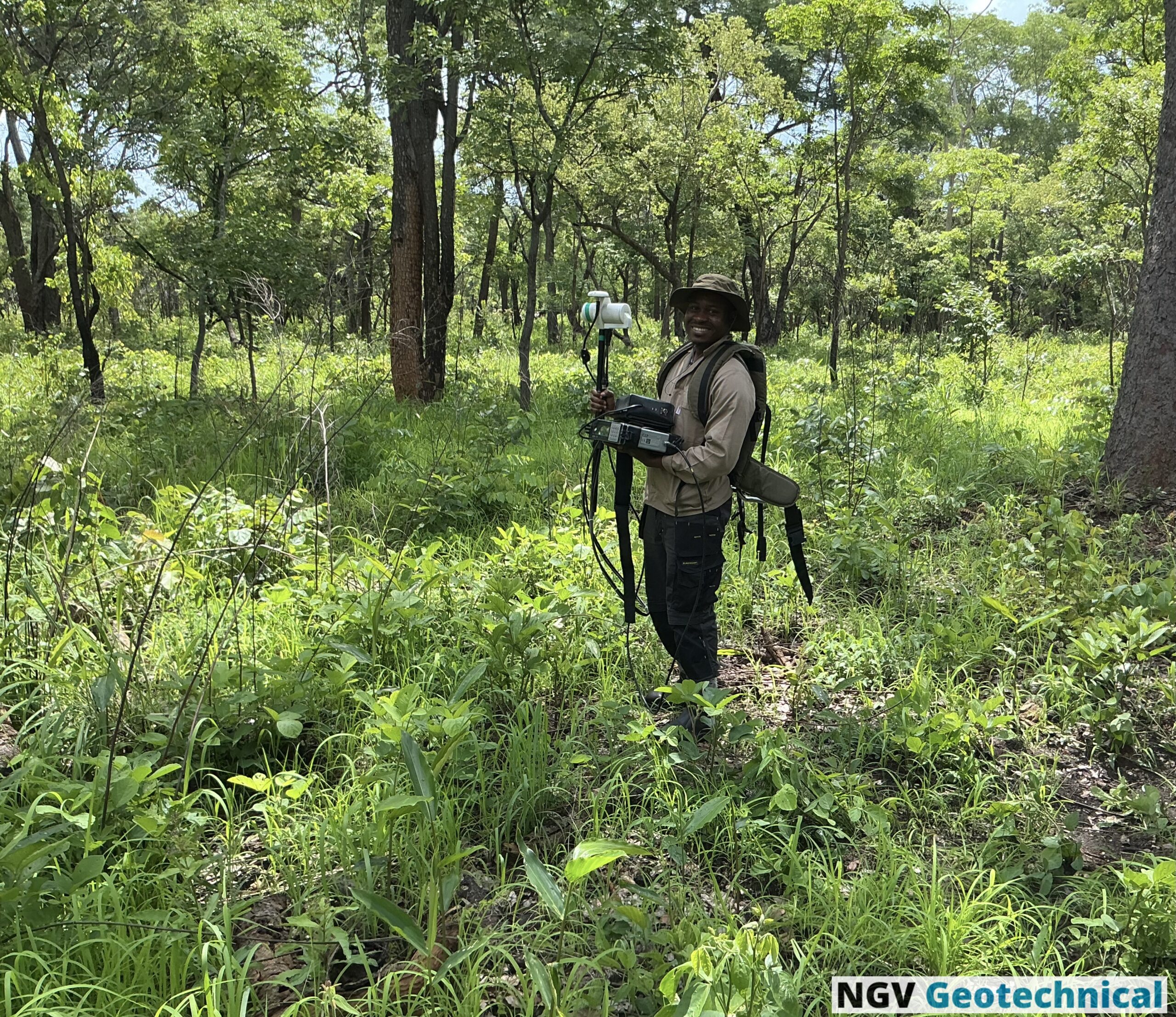
Core Geophysical Methods
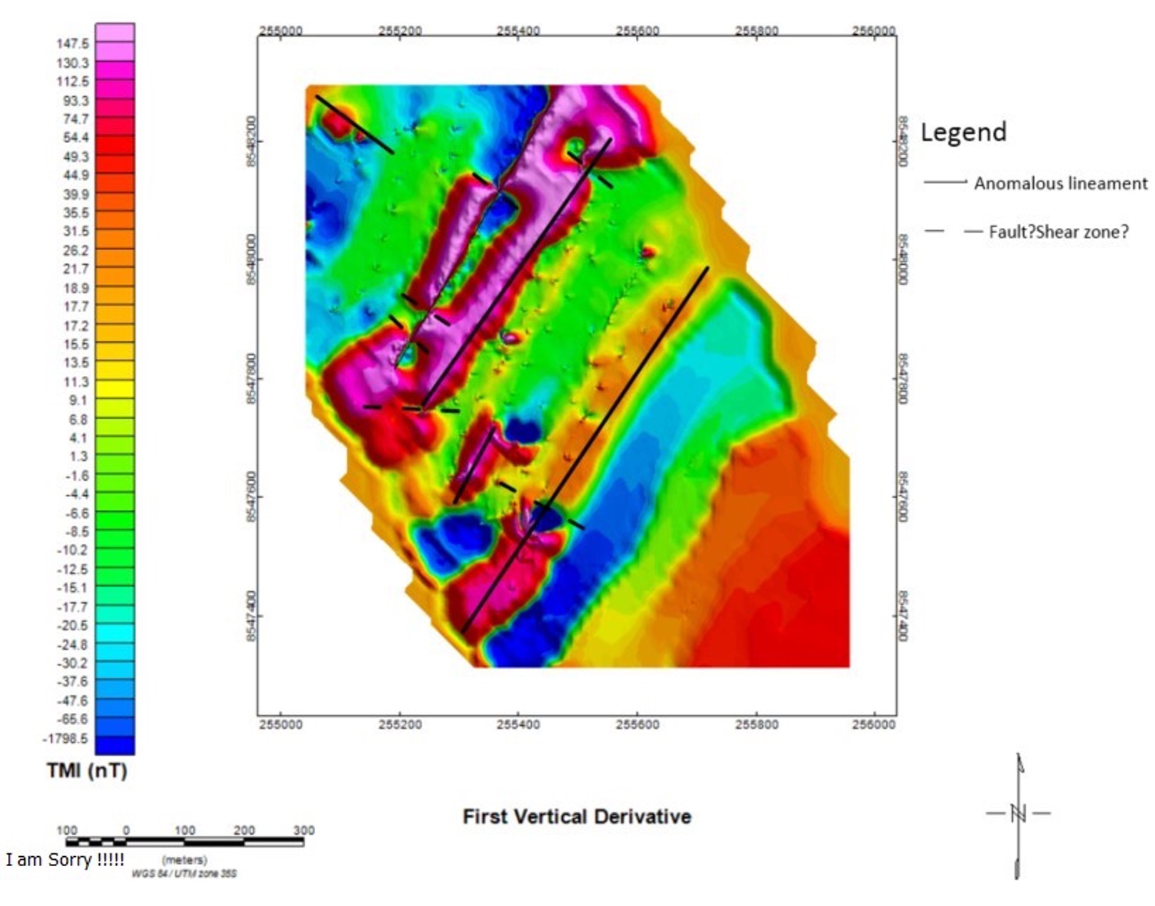
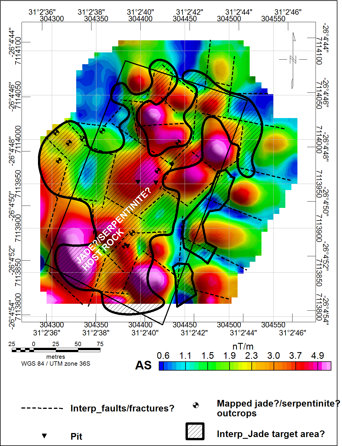
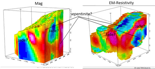
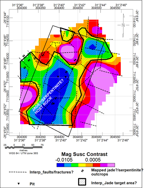
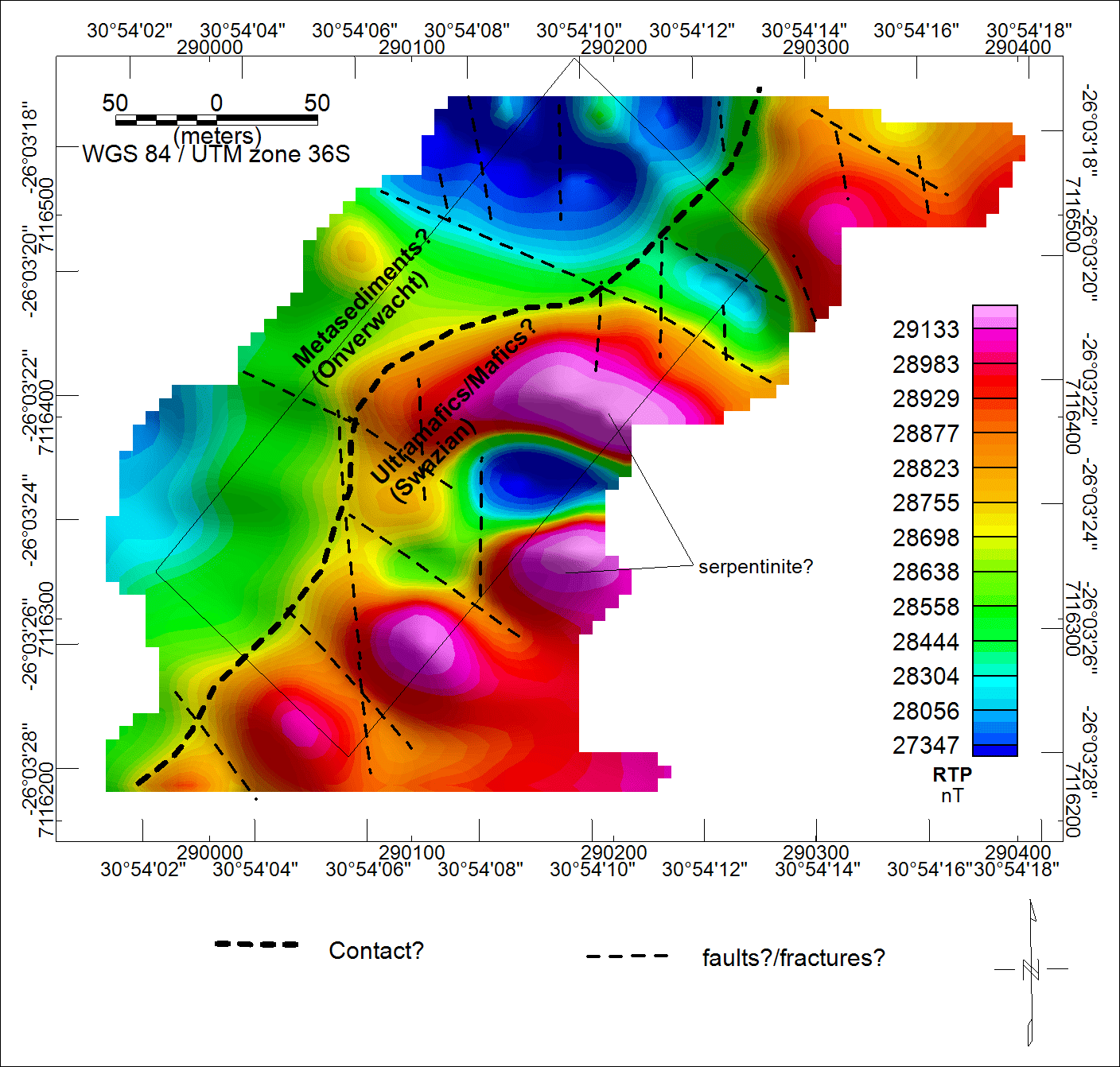
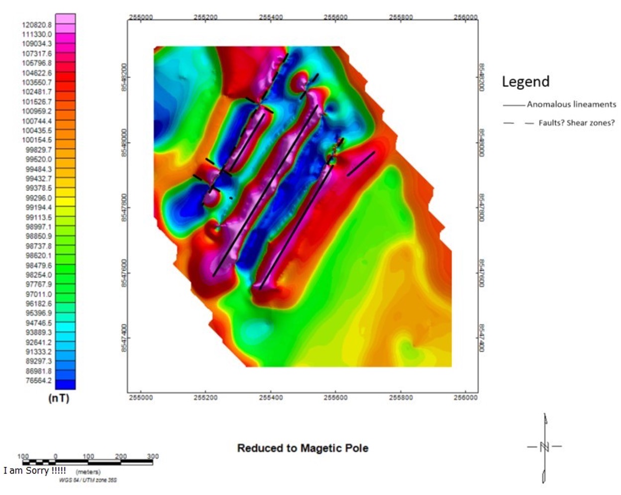
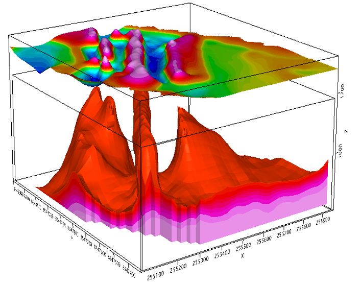
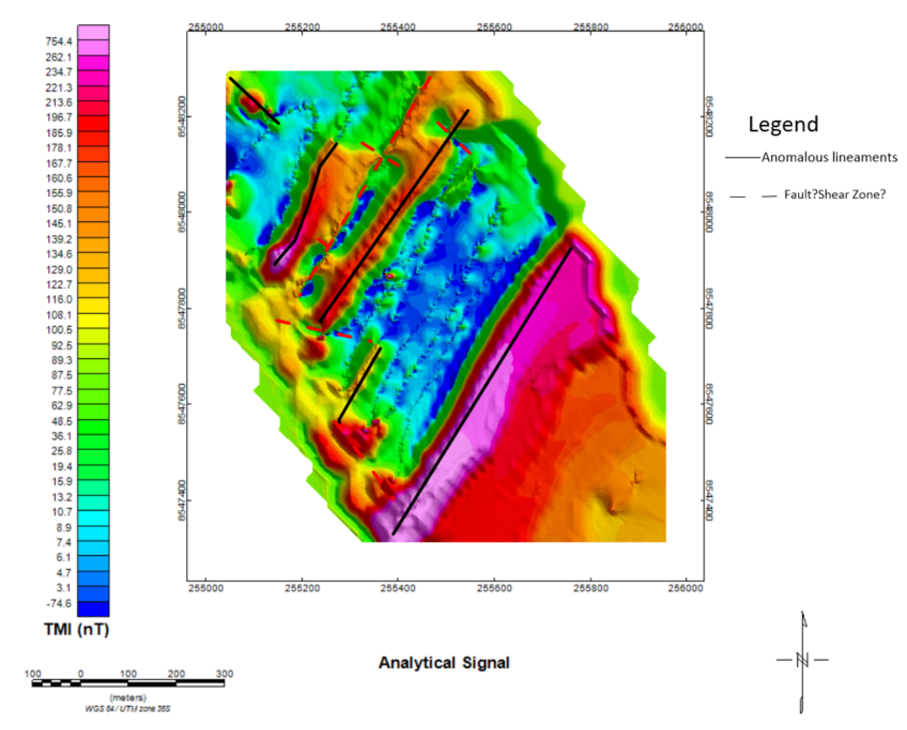
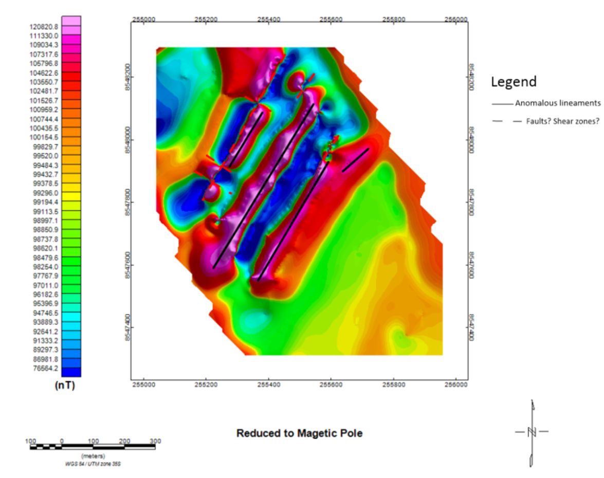
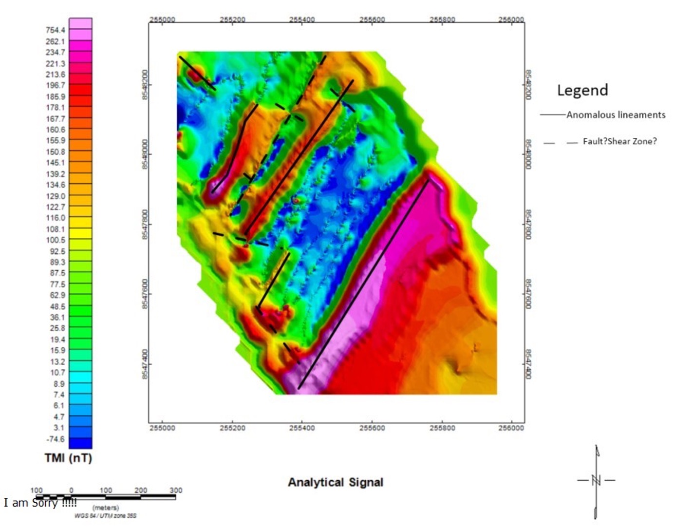
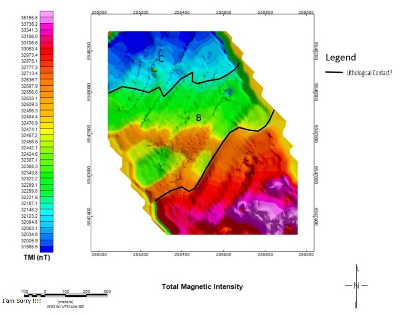
1. Magnetic Surveys (Ground & Drone)
We map variations in the Earth’s magnetic field to identify structural controls, such as faults, dykes, and lithological contacts. High-resolution ground & aeromagnetic data, often collected via integrated drone systems, allows for rapid coverage of large or inaccessible areas, revealing magnetic anomalies associated with mineralized systems
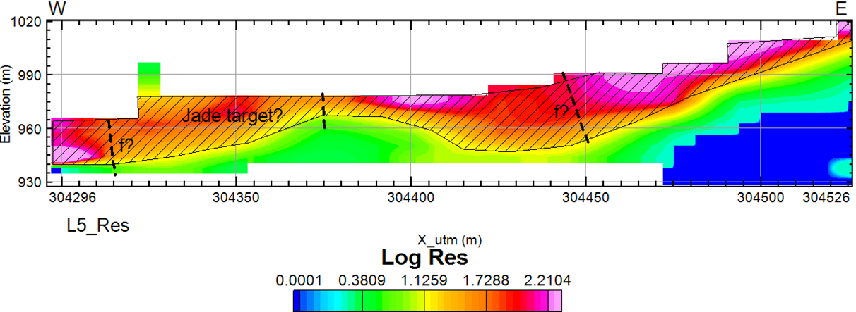
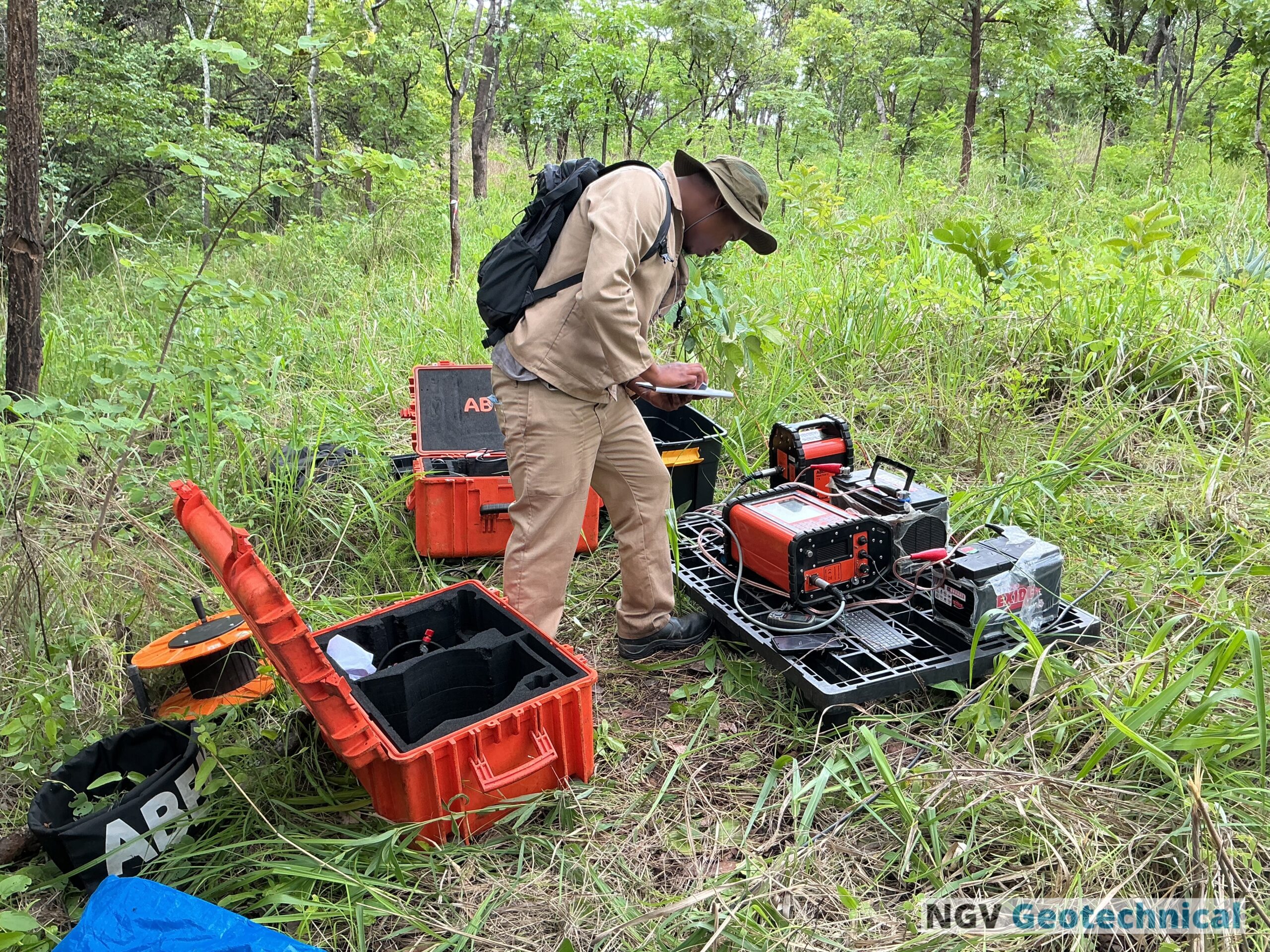
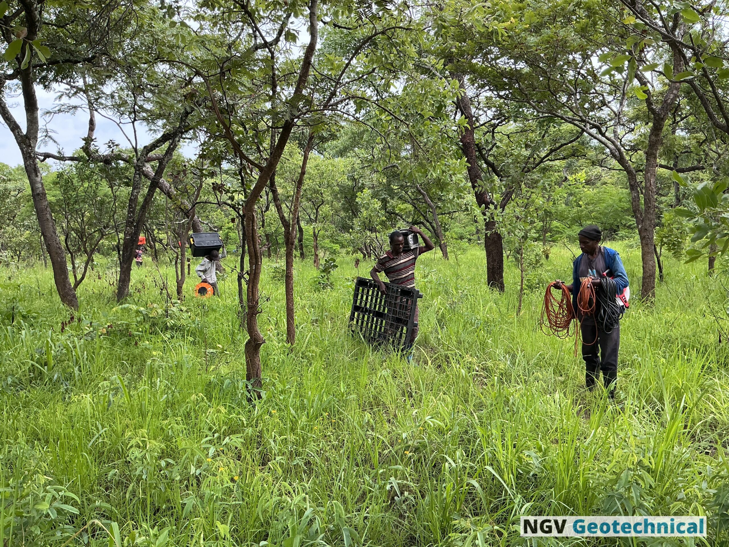
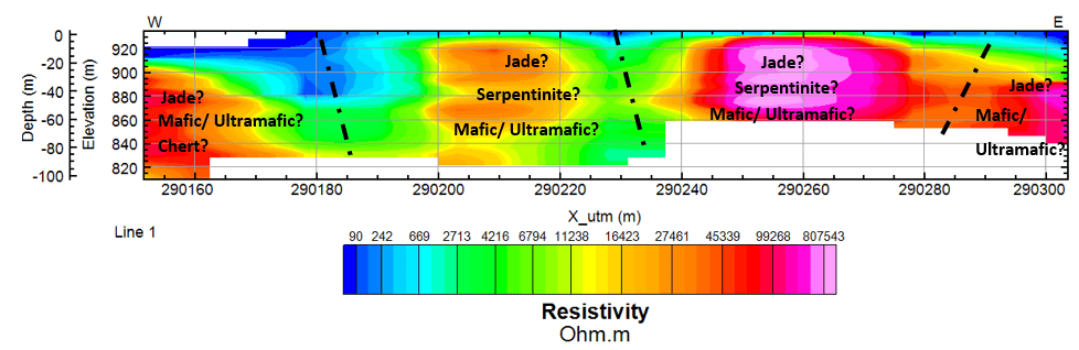
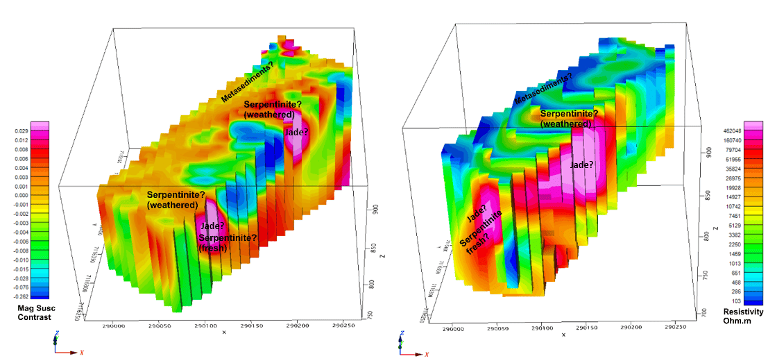
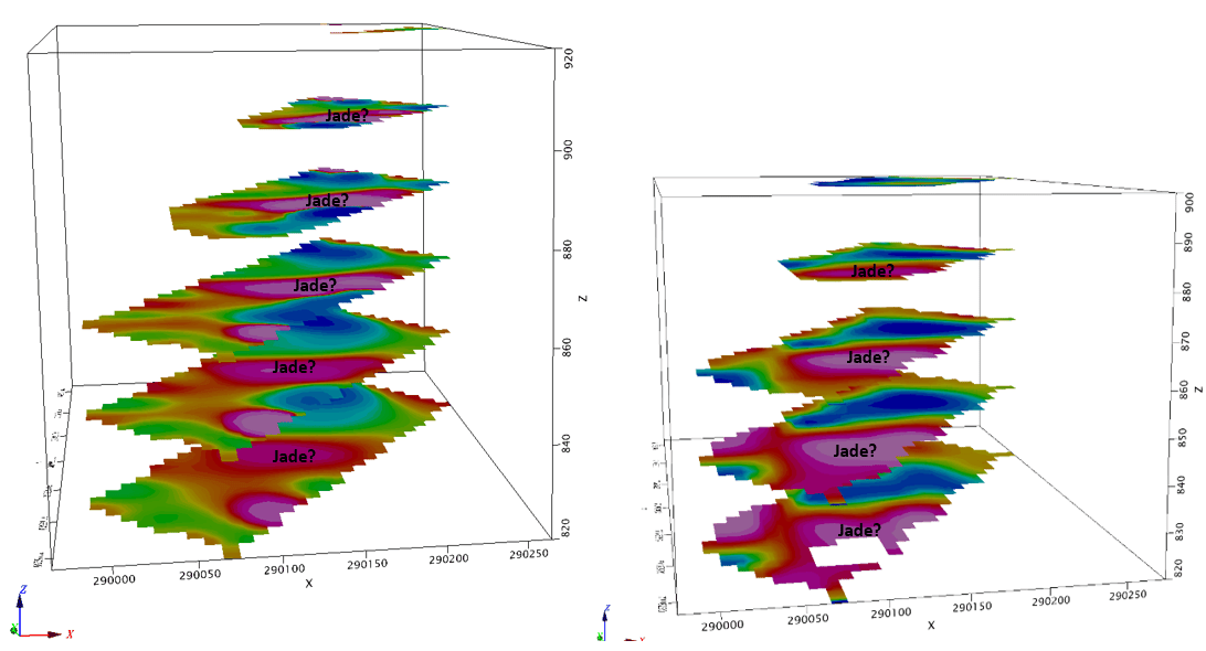
2. Electromagnetic (EM) & Resistivity
These methods measure how well the ground conducts electricity. They are essential for detecting massive sulphide deposits, mapping groundwater resources, or identifying clay layers and bedrock depth for geotechnical foundations.
3. Gravity Surveys
By measuring minute differences in the Earth’s gravitational pull, we can detect subsurface density variations. This is a primary tool for identifying large-scale structures, salt domes, and dense ore bodies (like hematite or chromite) buried deep under cover.
4. Induced Polarization (IP)
IP is the industry standard for detecting disseminated mineralization. By measuring the chargeability of the ground, we can identify mineral zones that might not be conductive enough for standard EM methods, such as porphyry copper or gold-bearing pyrite.
5. Seismic Survey
NGV Geotechnical sends sound waves into the ground and records how they reflect or refract off different rock layers. This is primary for mapping deep structural features.
Key Advantages
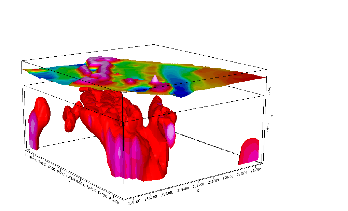
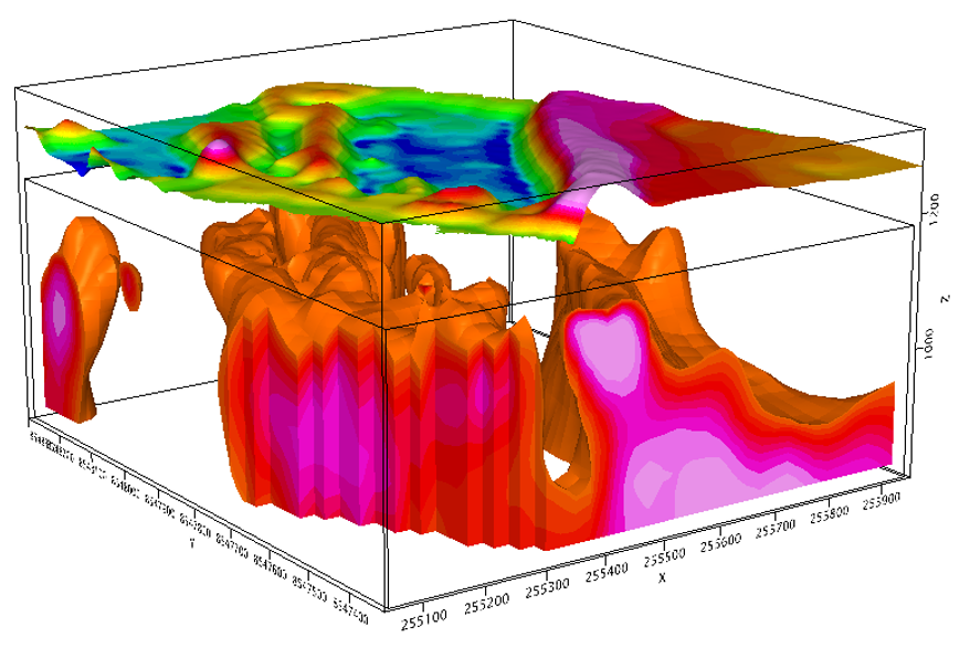
- Comprehensive Subsurface Imaging: Geophysics provides a continuous picture of the subsurface, helping to create detailed 2D and 3D models. This is a major advantage over isolated point data from boreholes, as it allows for the identification of subtle geological features, buried hazards, and structural variations that might be missed otherwise.
- Cost and Time Efficiency: Compared to traditional methods like extensive drilling programs, geophysical surveys can be much cheaper and faster. They allow for the rapid collection of a high volume of data over a large area, which helps pinpoint the best locations for subsequent, more expensive direct investigations like boreholes. This reduces the need for unnecessary drilling, saving both time and money.
- Non-Invasive and Non-Destructive: Geophysical surveys use indirect measurements, meaning they don’t require excavation or drilling. This is a huge benefit for projects in environmentally sensitive areas, urban settings, or on sites with historical significance, as it minimizes environmental impact and avoids damaging infrastructure.
Why Integrate Geophysics?
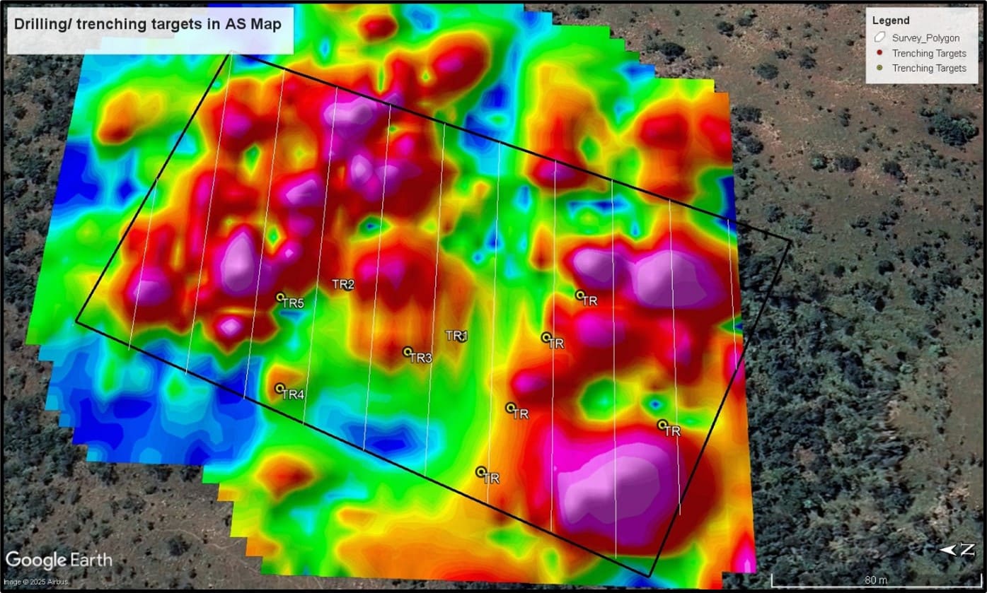
- Precision Targeting: Move from broad geological concepts to specific, high-priority drill targets.subtle geological features, buried hazards, and structural variations that might be missed otherwise.
- Depth Penetration: Gain insights into the blind geology hidden beneath thick overburden or transported regolith.
- Cost Efficiency: Drastically reduce exploration footprints and focus capital on the areas with the highest probability of success.
- Data Integration: Our results are processed into 3D models and GIS-ready formats (such as .shp or .dwg) for seamless integration into your project database.
Let Us Get Things Done
- (+27) 076 227 6808
- ngvgeotechnical@gmail.com
