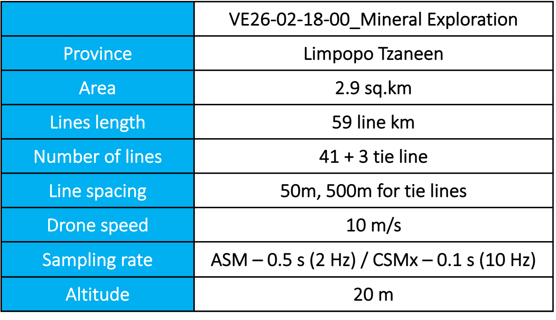
NGV Geotechnical provides high-quality aero magnetic survey services to support mineral, oil, and geological exploration projects.
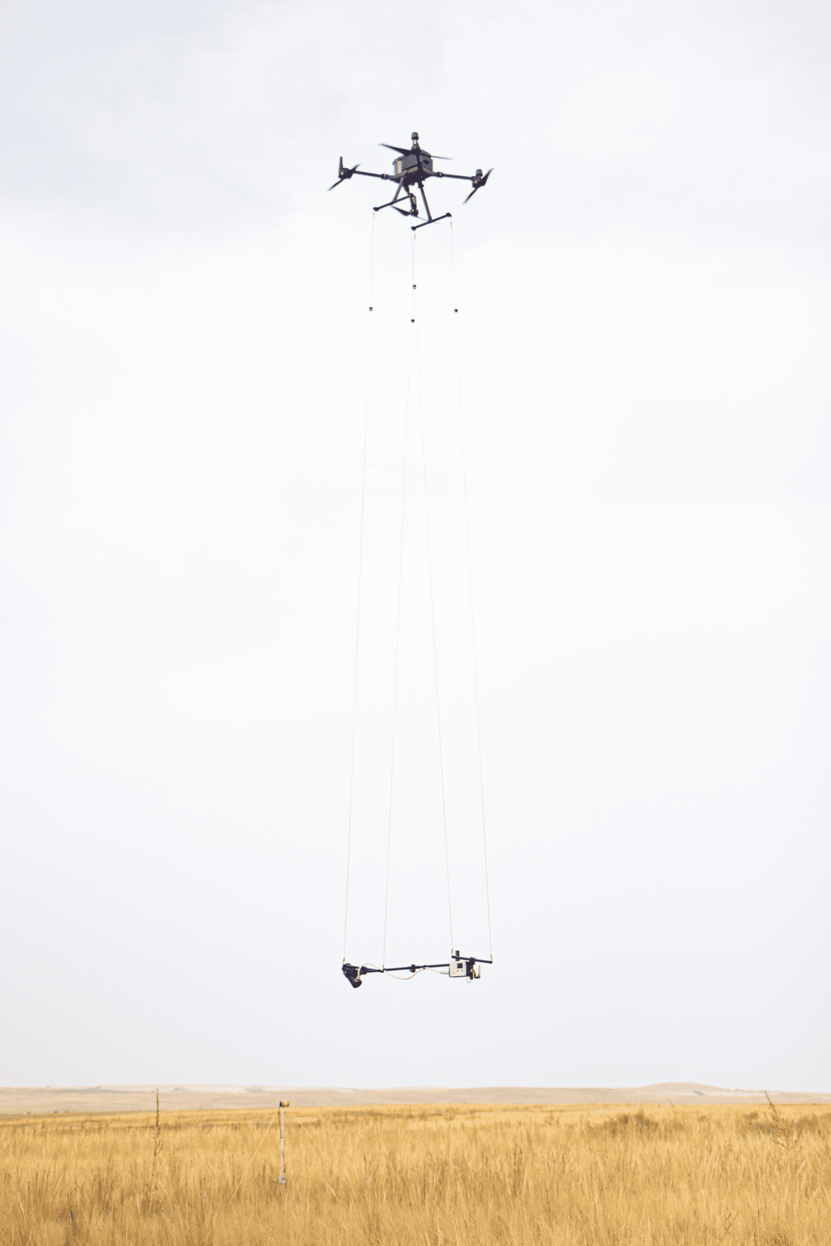
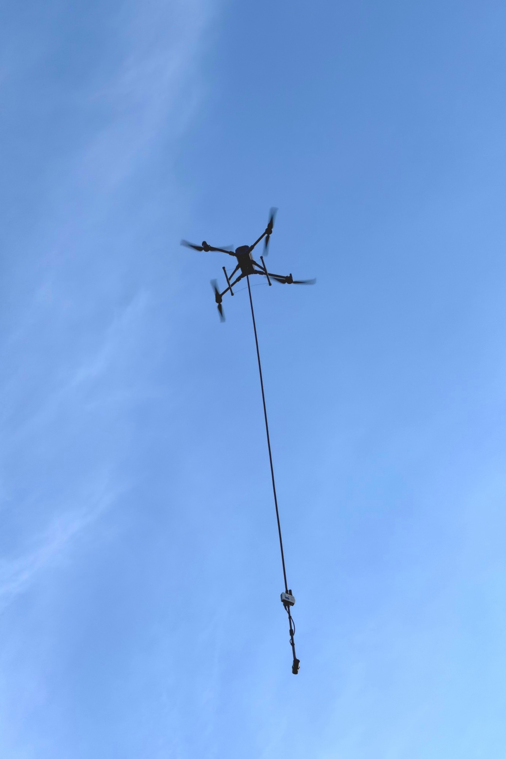
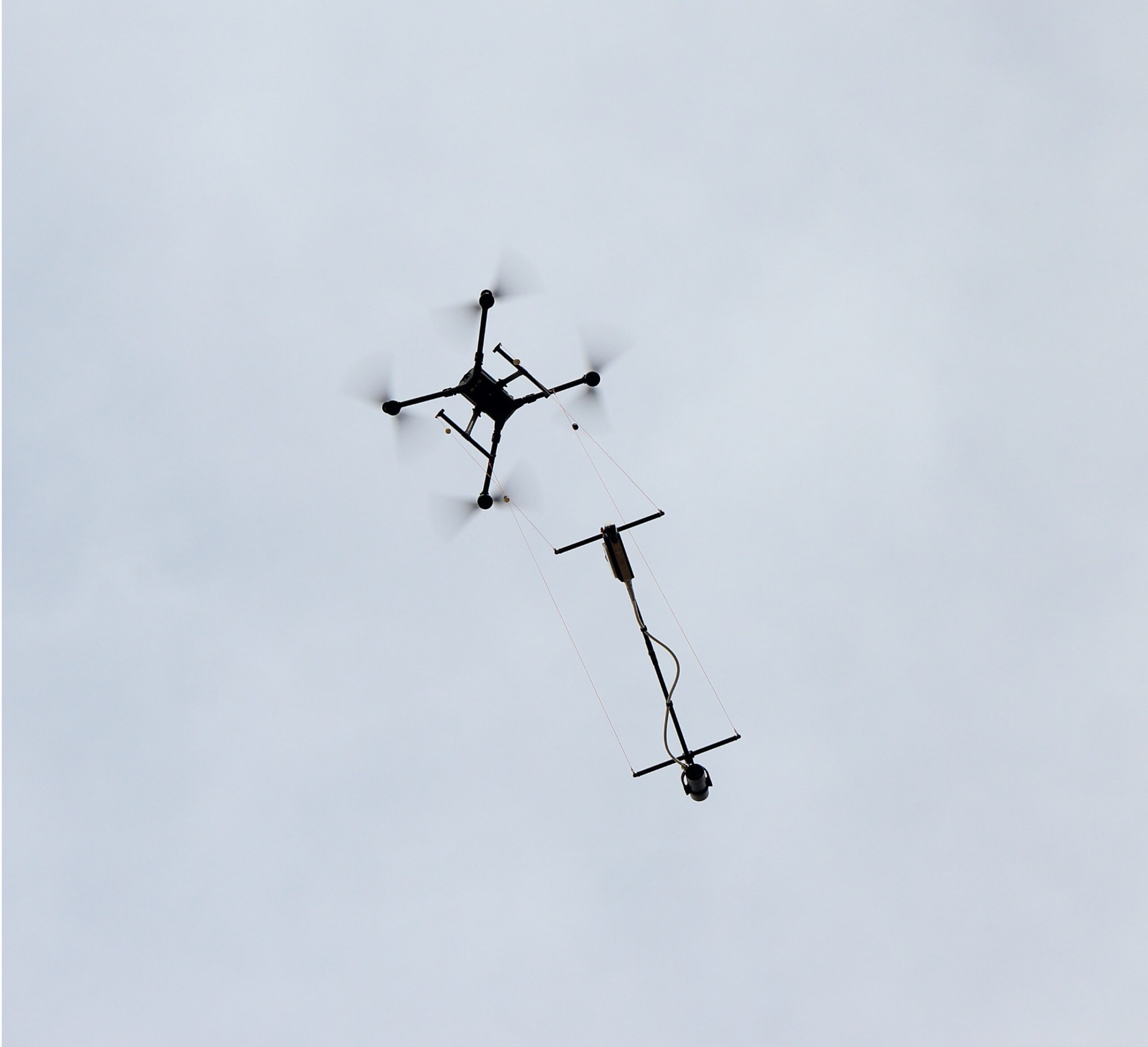
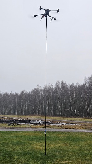
Using advanced drone magnetometer technology, we measure subtle variations in the Earth’s magnetic field to map subsurface geological structures and identify potential resource targets.
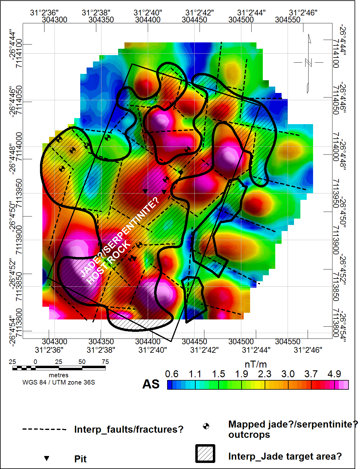
Our experienced team integrates precise data acquisition, processing, and interpretation to deliver accurate geophysical insights that guide exploration strategies, reduce risk, and improve project efficiency.
Mining & Mineral Exploration
Engineering & Environmental Infrastructure
Ground Water & Geothermal Exploration
Oil & Gas (Hydrocarbon Exploration)
Energy Transition & Renewable Projects
Academic & Government Research
Strategic Advantages of Aero Magnetic Survey
These services focus on the scientific process of finding, defining, and understanding the physical mineral deposit.
Precision Flying
By operating at low altitudes (10–30m), we capture high-frequency data that traditional manned aircraft simply fly over.
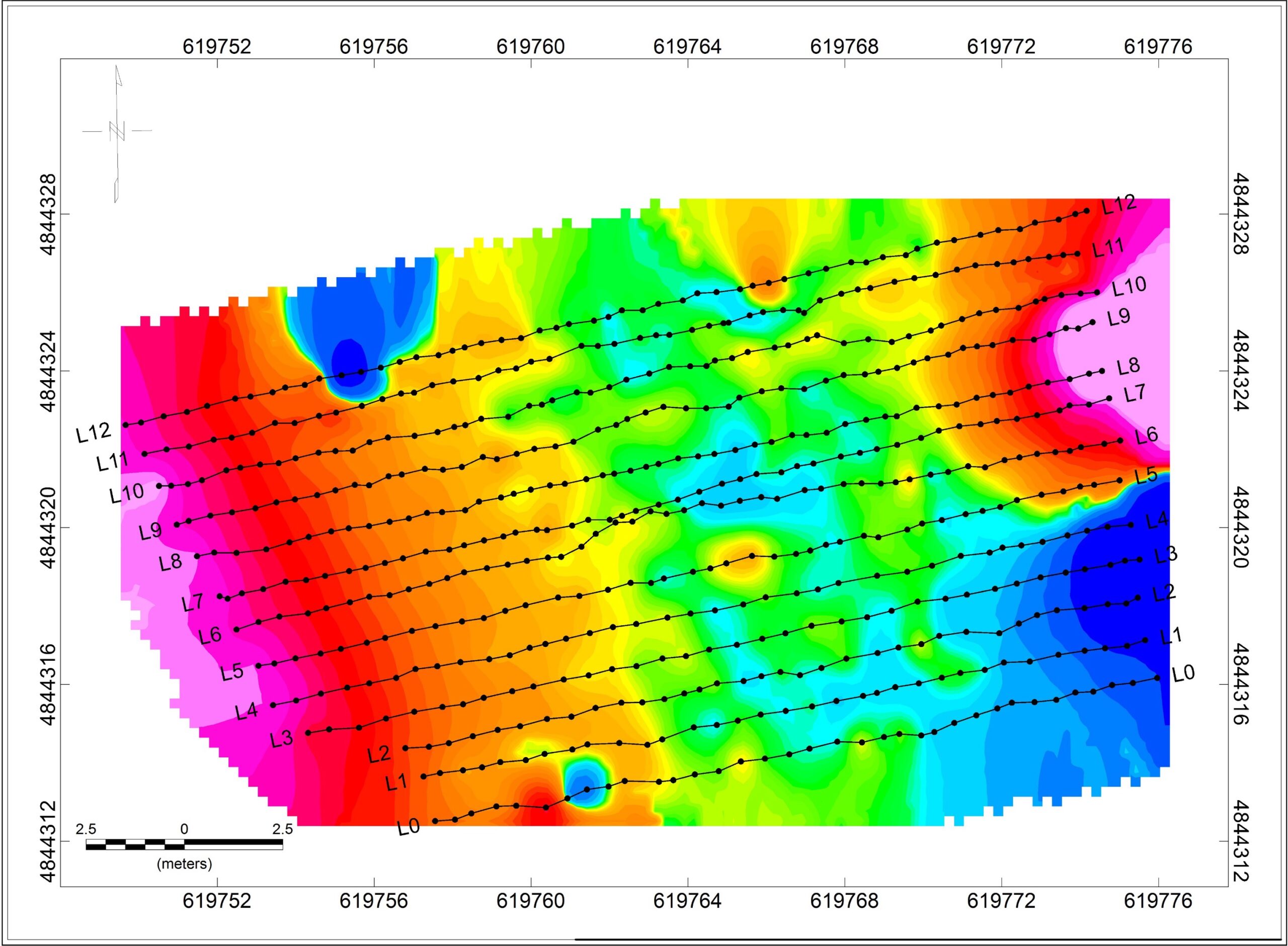
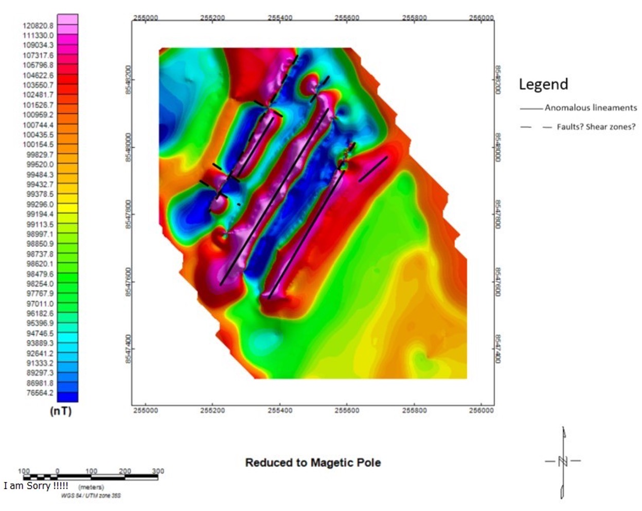
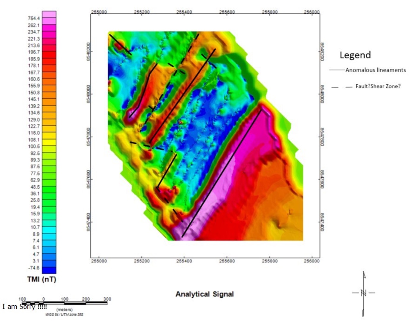
High-Resolution Structural Imaging
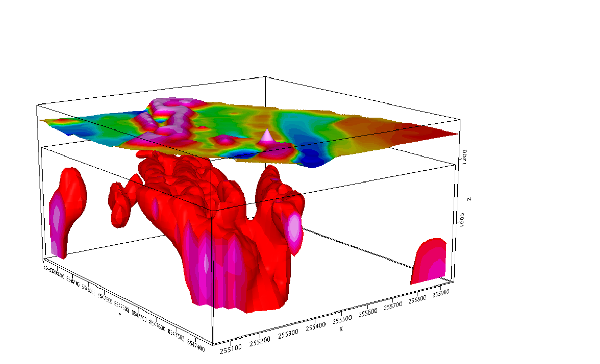
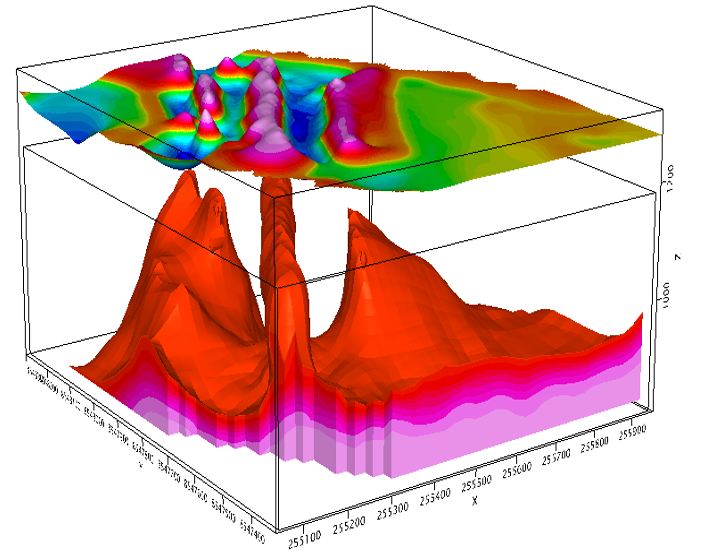
Our technology identifies deep-seated structural controls and basement architecture that are often invisible at the surface or obscured by thick overburden.
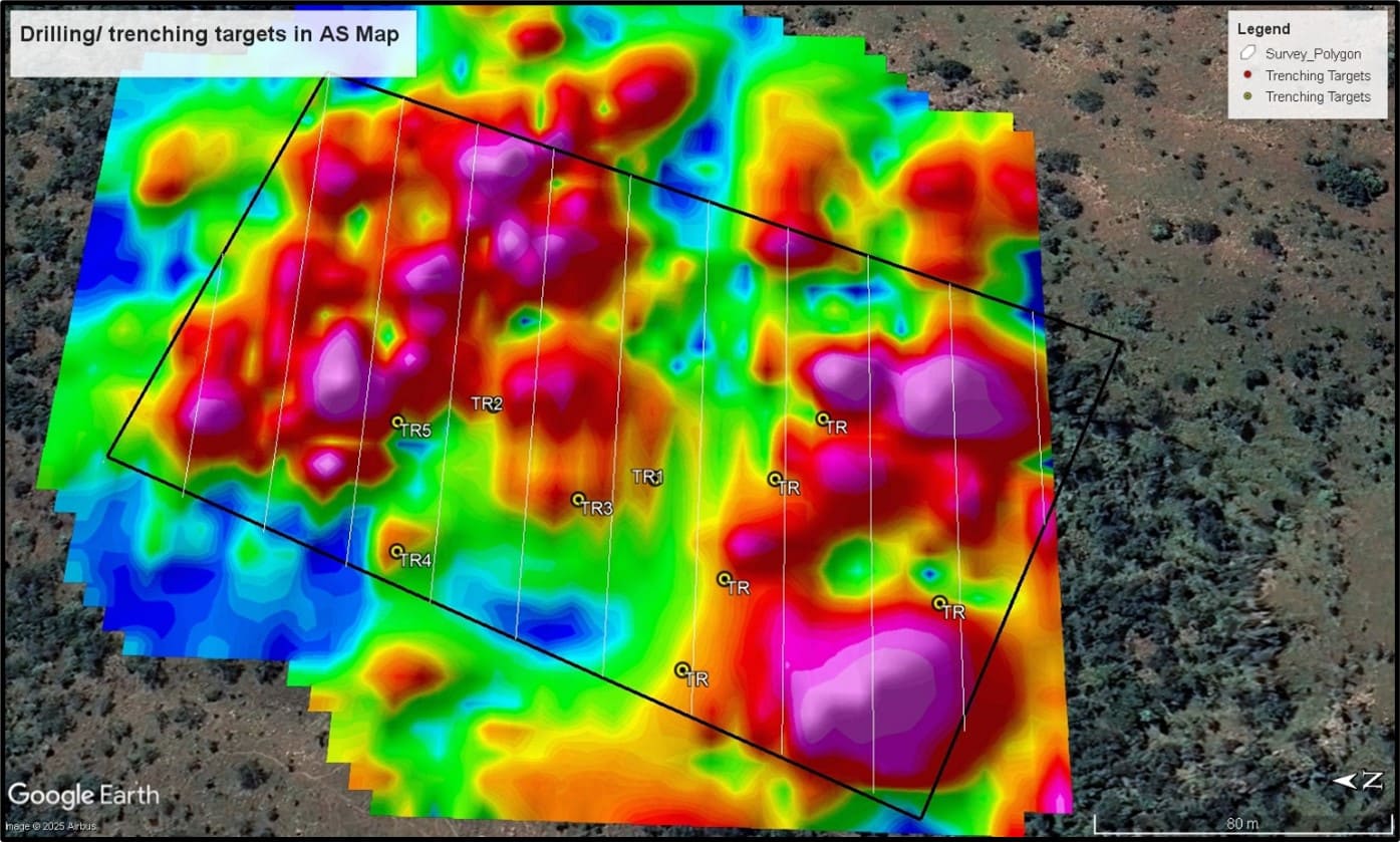
Cost-Effective Target Generation
By narrowing down high-priority zones from the air, we optimize the placement of subsequent, more expensive ground geophysical grids and drilling programs.
Exploration Intelligence
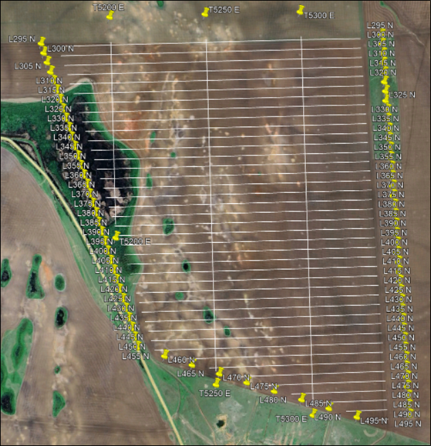
Our surveys provide the critical data needed for structural mapping, lithological identification, and pinpointing drill targets.
Rapid Deployment
Minimal footprint and quick mobilization mean we get your data processed and into your hands faster than ground teams.
Geophysical 3D Model
Technical Deliverables
We don’t just fly; we deliver actionable intelligence. Our standard outputs include: